England Coast to Coast Trek: Day 1

This year I decided it was time for an “active” vacation. The last one I had was the trip to Peru in 2012 (see blogs). Back in February I spent some time looking at the possibilities but the trip that caught my eye and fit into my work schedule was the England Coast to Coast walk. it is a 192 mile leisurely walk from St. Bees on the west coast of England to Robin Hoods Bay on the east coast. It wanders through the Lake District and the moors of Yorkshire taking paths through three of northern England’s spectacular parks. One of the nice things about it and what caught my eye, besides the attraction of beautiful, changing landscapes, is the fact that it is possible to hike “inn to inn”- sort of like a civilized backpacking trip- and it is easy to have arrangements made for you for both lodging and moving a bag each day. In addition detailed maps and information about the route are provided, so no planning is required. As a person with not much time and the desire to maximize my vacation adventure, this was the perfect opportunity! I grabbed three weeks of vacation, booked the trip, and when the time came flew to Edinburgh and took a train down to St. Bees to position myself for the start of the trip. That was yesterday. (For more information on the England Coast to Coast trip you can check out this link: https://en.wikipedia.org/wiki/Coast_to_Coast_Walk)

I stayed at a nice B&B in St. Bees right on the coast near the start of the walk It was a sunny day when I arrived but the wind coming off the Atlantic ocean was a bit chilly. That did not keep the local youth from converging at the park on the cliff by the sea. It was very crowded, or at least as crowded as a town of 2000 can supply. It was beautiful and I hoped the weather would hold- the forecast was uncertain for the next day- perhaps only overcast, perhaps rain later in the day. After my marathon of trains, planes, and automobiles to reach England I slept soundly.
In the morning, I packed my backpack assuming that rain would happen at some point, not a bad assumption in England any time of the year, but especially Northern England and especially near the coast. I got started early as I was not sure what awaited me. The first stage, St. Bees to Ennerdale Bridge mapped in at 14.5 miles and started by directing me north along the coast for about five miles where I would then turn inland. The sky was overcast and the wind light as I began the journey at 7:30am after a special order breakfast of eggs and grilled tomato. The path wound its way up the cliff and then proceeded to cross pasture after pasture as I moved north. There is an abundance of sheep in northern England, with some few cows keeping them company, all spread out in a seemingly infinite number of pastures. As I walked by the animals would look at me to determine if I was going to bother them or not. They did not seem to affected by my passage. I can only assume that I was just one of a constant stream of humanity passing by. day after day. The pastures were separated by gates and as the day went on I discovered that there are many different ways to design gates and many different ways to design locking mechanisms for gates. I counted at least seven different techniques over the course of the day.

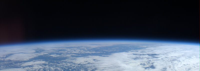
View looking up the north coast a few miles out of St. Bees.
It took a few hours to reach Birkham’s quarry where the path turned inland. The walk was beautiful. The Atlantic was to my left with a mist in the distance (which did not bode well for me later in the day!) and on my right the beautiful green rolling hills separated by rock berms or wire fences dotted with white – the ubiquitous sheep that I would come to find had free roaming rights in the Lake District. But finally it was time to say goodbye to the coast and I wandered down a country lane to find the next cross country segment of the path. Luckily I had been provided with an exceptional book with detailed maps or else it would be really easy to get lost. The C2C, while a popular trail, is not an official national trail and thus not uniformly well marked. The maps I had showed enough detail that I could navigate through towns and in pastures. For example, one instruction at the top of Dent Hill “turn left at the small cairn and head down the steep hill” was perfect and totally necessary.

Turning inland I walked along a country lane with sides taller than I am.
I found Dent Hill, which I reached around noon, to be especially challenging. It was more or less straight up and then straight down. Along the way it too, was dotted with pastures and I knew I was on the right path because I had a rock wall to my right as I climbed the but at the top. At about this time my luck ran out with the weather. Theoretically the view from the top of Dent Hill is spectacular but I could not see much. The clouds had rolled in and it started drizzling a bit, nothing too bad but enough that I had to put on my rain jacket. The wind on top of the hill was unpleasant, more so than the rain. It was incredibly steep coming down the hill so I pulled out my poles for extra assistance. After passing the small cairn a bit further down the steep part of the hill I came to an intersection and the path went in several different directions. Out came the compass! The map specified a NE heading and with a little work, a good guess, and my fingers crossed I figured it out. At least it let me calibrate my map- now I know what to expect when I am told “very steep”. No kidding!

Some of the curious but not alarmed random sheep I ran across
At the bottom of the hill, which I descended very slowly and carefully, i was cut off from the wind, but the rain was getting a bit more serious. The trail here was beautiful though. It ran along a stream between various hills and was pastured off on one side with picturesque rock walls. And yes, more sheep were wondering around, both inside and outside of the pasture. The rain got bad enough I decided to stop and get my poncho out in an effort to keep my backpack somewhat dry. I also had been carrying my book for quick references to the directions and the maps- something that is needed often- and it was starting to get wet so I held it under the poncho to keep it dry. Which is probably why, right at the end of the day, with only about two miles to go, I made a wrong turn. The rain was coming down steadily enough that my legs and boots were getting wet (at this point it would have been awkward to stop to put my rain pants on and besides— I was almost done!) and I was ready to call it a day. BUT the wrong turn added an extra mile or two so I got to enjoy an English summer shower for a bit longer, along with the wind.

One of the more challenging
Getting to my stop for the evening, the Stork Hotel, was wonderful. I am now dry, warm, and sitting in the pub having a beer while my clothes and boots dry out in my room. The rain has picked up a bit more so I can only be glad that I started so early. So far tomorrow looks like it will be a bit better.
All in all it was a great day. I ended up walking somewhere around 16-17 miles, with the bonus mileage from the wrong turn. I was outside and hiking, seeing new things and meeting people along the way (and sheep!). I look forward to what the next days will reveal (although I suspect one thing will be some stiffness and sore muscles tomorrow). But for tonight, I look forward to a well deserved rest after watching the European cup game in the pub.
Beautiful description of your trek! I can just picture the English coast and sheep-filled countryside. I’ve been thinking of you. Enjoy your walkabout, Sandy!
great posting Sandy. I did the Hadrian’s Wall back in 1996 on my bike – it was quite a challenge!
glad to read you back! >
Hurray, mom is happy, she knows where you are. Enjoy! The country sounds beautiful.
Will look forward to more. Love, mom